Summary
The article discusses POTATo (Platform for Optical Topography Analysis Tools), a MATLAB-based software for analyzing fNIRS data, developed by Hitachi, Ltd. It covers POTATo's capabilities for data organization, exploratory analysis, visualization, and custom plug-ins, emphasizing its use of 2D coordinates for sources and detectors.
Core Features
POTATo was established by integrating four essential element functions, the compatibility of data handling, ease of exploratory data analysis (EDA) and model diagnostics (MD), and result/data presentation in a holistic platform.
Functionalities
These functions enable users to:
- Organize particular datasets in separate POTATo projects;
- Modify the projects by importing additional data, exporting, or merging with other projects;
- Conduct EDA to roughly understand raw data;
- Visualize raw data, transient-pre-processed signal, and statistical results, and,
-
Verify MD via statistical analysis functions presenting parallelism between EDA and MD.
Plug-In Features
fNIRS analysis is an area of ongoing development, with researchers working to introduce new analysis methods. POTATo includes a plug-in feature that allows users to create custom functions, integrate them into the POTATo package, and use or compare them with existing POTATo functions.
More information, including a handy tutorial, may be found in a paper by Sutoko et al. (2016).
2D vs. 3D Coordinate Handling
While other analysis software uses 3D optode positions to load the data sets (nirsLAB, Homer2/3…), POTATo loads two parameters in the *probeInfo.mat* file called coords_s2 and coords_d2 (Figure 1) corresponding to the sources and detectors coordinates in the 2D space (Figure 2).
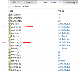
Figure 1: Two parameters in POTATo GUI in the probeInfo.mat file called coords_s2 and coords_d2.
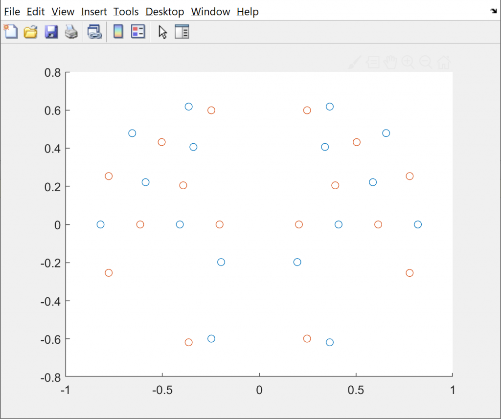 Figure 2: Sources and detectors and coordinates pictured in 2D space within POTATo.
Data Conversion Script
For these reasons, the need to include 2D coordinates in the .nirs file has arisen. This linked script converts raw data to the .nirs file including both sets of 3D and 2D coordinates.
References
Sutoko, S., Sato, H., Maki, A., Masashi Kiguchi, Hirabayashi, Y., Hirokazu Atsumori, Obata, A., Tsukasa Funane, & Takusige Katura. (2016). Tutorial on platform for optical topography analysis tools. 3(1), 010801–010801. https://doi.org/10.1117/1.nph.3.1.010801.